
Trail
Description
![]()
New &
Future
Trail
Map
![]()
Bay Area Parks
![]()
Bay Area Rec & Travel
![]()
Bay Area Back Pages
![]()
Bay Area Biking
![]()
Bay Trail
![]()
Feedback
Detailed Trail Mileage Notes and Pictures
![]()
This page has detailed mileage readings, with
descriptions and pictures of the trail. The mileage readings were taken
from a bicycle odometer, with a resolution of 0.01 miles (53.8 feet).
Your
mileage
may vary. The mileage readings and descriptions are from 2004.
See here for a map
of the Coyote Creek Trail.
See here for a map
of Hellyer
County Park.
Coyote-Hellyer County Park to Morgan Hill:
The following are trail mileage notes on the paved Coyote Creek Trail from the official start of the trail in Hellyer County Park to the end of the trail in Morgan Hill, then to Anderson Lake County Park. This trail is maintained by the Santa Clara County Parks Department.Click on the thumbnails to see a bigger picture. Click on the "Back" button of your browser to return. Note that the pictures are representative of the general area, not necessarily of the exact same spot. They may be shot looking either up or down the trail. The pictures were taken on different dates and at different times of the year. Some are a few years old, so the trail appearance or conditions may have changed.
| Miles | Thumbnail | Description |
| 0 |  |
Trail mileage starts at Coyote Creek crossing in Hellyer County Park |
| 0.19 |  |
Hellyer Avenue under-crossing |
| 0.20 |  |
Bridge over Coyote Creek goes off to right to Palisade Dr. |
| 0.40 | Dirt paths to left lead to lake parking lot | |
| 0.52 |  |
Paved path on left leads to end of lake parking lot |
| 0.80 |  |
Paved path on left leads to east side of lake |
| 0.85 |  |
Highway 101 under-crossing |
| 0.89 |  |
Path on left to disk golf course, shady trail ahead |
| 0.99 |  |
Start of dirt section of trail |
| 1.02 |  |
End of dirt section of trail, hill begins on left |
| 1.03 |  |
Small dam on creek, next to trail on right |
| 1.24 |  |
Landslide area on left, see ridge above |
| 1.27 |  |
Dip in trail, sunnier |
| 1.56 |  |
Trail turns to right, then rises up, with view of hills, open fields, industrial bldgs. |
| 1.69 |  |
Begin oak-shaded section |
| 1.73 | See stairs down to creek on opposite bank | |
| 1.89 |  |
Path to parking lot of industrial bldg. on left, path next to hill. |
| 1.92 |  |
End of hill |
| 2.10 |  |
See huge warehouse on the left |
| 2.21 |  |
Dirt path down to the creek on right |
| 2.34 |  |
Bridge to Shady Oaks Park on right |
| 2.50 |  |
Dip in trail, formed by drain, forms path to industrial park parking lot on left |
| 2.75 |  |
Industrial bldgs end, open fields begin |
| 2.90 |  |
Silver Creek Valley
Road under-crossing. Just before the brige, a path leads east to the
new Silver Creek Staging Area. |
| 2.98 |  |
Bridge over Coyote Creek, exit to Piercy Road on left |
| 3.04 |  |
Large dirt parking lot was here. Now is a paved road with no parking. Trail drops down to creek, wide pool in creek fed by stream. |
| 3.16 |  |
Trail rises up again |
| 3.24 |  |
Old orchard, 101 on the right, scattered oaks provide shade |
| 3.62 |  |
Fence on right, restoration area, wide part of creek below on the left |
| 3.70 |  |
Levee trail between percolation basins on the left |
| 3.79 |  |
Turn left at open field |
| 3.79 |  |
Open field on right, percolation pond bed on left |
| 3.96 | 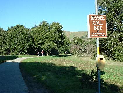 |
Call box, turn right, abandoned orchard |
| 4.20 |  |
End of Eden Park Place, trail parallels the road |
| 4.27 | Opening in fence to Eden Park Place | |
| 4.36 |  |
Opening in fence to Eden Park Place |
| 4.59 | Intersection of Silicon Valley Blvd. and Eden Park Place | |
| 4.62 |  |
Silicon Valley Blvd. under-crossing |
| 4.69 | Trail entry at south side of Silicon Valley Blvd. | |
| 4.70 |  |
First bridge over overflow channel to open field on right |
| 5.04 | 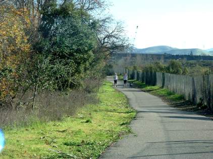 |
Habitat restoration area on the left |
| 5.07 |  |
Second bridge over overflow channel to open field on right |
| 5.29 |  |
Begin Hwy 101-85 freeway under-crossings |
| 5.41 |  |
End of Hwy 101-85 freeway under-crossings |
| 5.47 |  |
Drinking fountain on right, suburbs begin on right, creek and pond on left. Forsum Road on right, old oaks provide scattered shade |
| 5.82 |  |
Metcalf Park, gravel path goes up levee on left, paved path follows park. |
 |
Dam on creek at end of water skiing pond | |
 |
Bench at end of water skiing pond | |
 |
Small beaches on side of water skiing pond | |
 |
Park lawn ends, trail runs close to Forsum Road | |
| 6.28 |  |
Parking lot on Monterey Hwy for the park and trail |
| 6.37 |  |
Paved trail joins levee trail, bench on bank above water ski pond |
| 6.46 |  |
Boat dock on pond, bench, picnic table, beyond is gate to launching ramp on pond |
| 6.65 |  |
Cross bridge over creek, turn right at fence |
 |
Parkway Lakes is beyond the fence on the left | |
| 6.72 |  |
Stop at Metcalf Road, crosswalk crosses road, Metcalf substation and Coyote Ranch Rd. on left |
| 7.28 |  |
Big open field on left, can see east hills, end of Metcalf substatiion |
| 7.42 |  |
Trail drops slightly, enters shady portion |
| 7.57 |  |
Intersection with road to Coyote Ranch, turn left onto road, equestrian trail goes ahead through field |
| 7.63 |  |
Coyote Ranch entrance, turn right |
| 7.75 |  |
Start of fenced schutzhund dog club area on right |
| 7.83 |  |
Entrance to dog area, trail crosses canal, trail branches right |
| 7.94 |  |
Trail drops down, crosses creek, may be closed if flooded |
 |
Trail turns right by end of pond, then climbs back up and turns left | |
 |
Large fishing pond on the left, trails drop down to pond | |
 |
Farms on the right of trail | |
| 8.33 |  |
Trail turns left at corner of pond, dirt trail on right goes to Monterey Hwy, orchard ahead |
 |
The trail runs past the end of the pond on
the left |
|
| 8.41 | 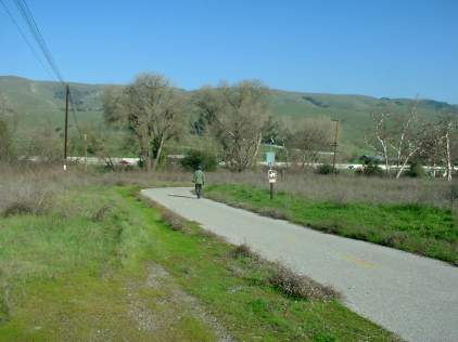 |
Turn right, call box, horse crossing, drop down to creek crossing |
| 8.50 |  |
Creek crossing, creek flows through culvert a few inches below trail surface, climb up. Turn right after creek crossing, 101 and field with low bushes on the left, trees on the right. |
| 8.81 |  |
Trail curves away from creek, open fields on both sides |
| 8.90 |  |
Near creek again, more shade |
| 8.98 |  |
Turn right, can see 101 going uphill |
| 9.12 |  |
No shade, low vegetation, long stretch through open field |
| 9.58 |  |
Near north end of Coyote Creek Golf Course, follow golf course north fence, grassy field on right |
| 9.70 |  |
Turn left along west
fence of golf course,
creek overflow bed on right. |
 |
Creek is beyond berm past overflow bed | |
 |
old concrete structures in field on right | |
 |
Trail runs in and out of shade from tall sycamores and other trees | |
| 10.34 |  |
Sycamore Rest Area, with tables, benches, hitching post, call box |
| 10.46 |  |
Turn right at gate on Riverside Road, leads left to golf course, trail parallels road |
| 10.52 |  |
Trail partially washed out, creek runs through 2 sets of pipes under the road |
| 10.83 |  |
Cross Riverside Road, scattered trees, farms on right, marsh plants on left |
| 11.09 |  |
Washed-out section of trail with small pond, bypassed by new section |
| 11.23 |  |
Cross creek bridge |
| 11.23 |  |
Go through field, marsh on right, dry grasslands on left |
| 11.59 |  |
Turn right at embankment at edge of golf course |
| 11.82 |  |
Turn left at levee by Ogier Quarry Pond |
| 11.98 |  |
Trail runs slightly uphill as it curves to the left, then
it turns right |
 |
Eucalyptus rest area on right, has shade, tables, call box. | |
 |
Wind through flat fields, then run parallel to pond on right | |
| 12.55 |  |
Ogier Road intersection, stay on trail to left |
| 12.62 |  |
Old RR flat car used as loading platform, hilly open field, marshland on left |
| 12.86 |  |
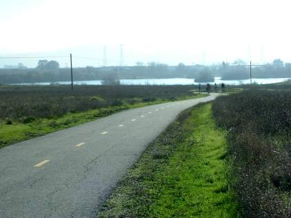
Fenced pond on left, road on right |
| 12.97 |  |
Intersection with road to SCCMAS model airplane skypark, trail crosses to right |
| 13.09 | Start of SCCMAS parking lot | |
| 13.14 |  |
End of SCCMAS parking lot, restrooms, turn left. Trail runs along end of SCCMAS runway, fence on left, don't stop |
| 13.52 |  |
Long curve to right, runs close to 101 on left, see creek on right |
| 13.90 |  |
101 under-crossing. Parallel dirt levee on left, beyond are open fields |
| 14.32 |  |
Intersection with bridge over canal on left |
| 14.58 |  |
Oak Rest Area and Sycamore Nature Trail ahead |
|
Turn left. An old farm road goes straight into a field with old farm buildings near the hills. The trail turns right. There's an old barn on the right. | |
| 14.81 |  |
Intersection with Sycamore Nature Trail, turn right |
| 14.84 |  |
Cross long, wide bridge over Coyote Creek, beyond is intersection with dirt road (equestrian trail). Trail winds through old orchard |
| 15.03 |  |
Path to Eagle View Drive, trail parallels street separated by fence, park ranger station on left |
| 15.29 |  |
End of Coyote Creek Trail at Morning Star Drive |
This is the end of the Coyote Creek
Trail. Just a short distance away, but not directly connected yet, is
Anderson Lake County Park.
Coyote Creek Trail to Anderson Dam
The description below describes how to get to Anderson Dam. Anderson Lake County Park begins here. The route below follows Malaguerra Drive to Cochrane Road. Cochrane Road is narrow, heavily-trafficked, and has no bike lanes. It is hazardous for pedestrians and bicyclists, so travelling on it is not recommended. However, the trails through the park, which are safer, are somewhat complicated to describe, so mileage follows along Cochrane Road for simplicity.
| 15.29 | End of Coyote Creek Trail at Morning Star Drive, turn left, then right on Malaguerra Drive | |
| 15.36 | Intersection of Malaguerra Drive and road to correctional facility on left | |
| 15.60 | Cochrane Road intersection, turn left onto Cochrane | |
| 15.71 | Entrance to Anderson Lake County Park parking lot on left | |
| 15.84 | Exit of parking lot, path crosses creek on bridge | |
| 15.95 | Hydroelectric plant on right | |
| 16.12 | Road leads to farms on right | |
| 16.17 | Dam outlet gate on left | |
| 16.21 | Intersection of road up dam on right |
Hellyer County Park to Stonegate Park
The following are trail mileage notes from the trail segment from Hellyer County Park north to Stonegate Park. This section of trail was built and is maintained by the City of San Jose.
| Miles | Location |
| 0 | Trail start across creek in Coyote Hellyer County Park |
| 0.05 | Park restroom |
| 0.22 | Start of velodrome parking |
| 0.30 | Intersection of gravel road leading out of park, take right fork |
| 0.40 | Park road, start of gravel trail on right near creek, take trail |
| 0.45 | Pass behind Sylvandale Group area |
| 0.59 | Dirt trail behind Yerba Buena group area, go under Yerba Buena under-crossing |
| 0.63 | Yerba Buena under-crossing entrance |
| 0.63 | Entrance to undercrossing at Yerba Buena and Grandbrook Way |
| 0.68 | Gate at trail near fenced-off field, runs next to field on left, creek on right |
| 1.02 | Descends to Singleton Road |
| 1.07 | Singleton Road and creek crossing at creek-level, goes up, turns left past creek |
| 1.13 | Paved trail turns into gravel path |
| 1.20 | Trail is paved again |
| 1.32 | Capitol Expressway undercrossing |
| 1.37 | North of Capitol Expwy, trail junction, path on right leads to Tuers Rd, take left fork |
| 1.45 | Trail passes through gate at far end of driving range at Los Lagos Golf Course |
| 1.57 | Start of driving range |
| 1.66 | Locked gate to golf course |
| 1.69 | End of fence along golf course |
| 1.93 | Trail goes uphill, hill blocks view of gof course |
| 2.12 | Bridge across creek for golfers only |
| 2.14 | Trail goes uphill next to the golf course behind a fence |
| 2.21 | Fence ends, trail goes downhill |
| 2.36 | Trail goes uphill, there's a fence again |
| 2.47 | Entry to Stonegate Park, sidewalk begins, follow sidewalk through park |
| 2.53 | Entry path to Stonegate Park from street |
| 2.57 | Gap in fence along creek, steep dirt path to creek |
| 2.65 | Skate park |
| 2.68 | End of paved path in park near San Jose Mounted Police Unit stables |
2009 update note: There is a new paved section of trail in
Hellyer County Park leading to the Yerba Buena Road undercrossing.
Also, in 2009, a short new section of trail opened up, running along
the creek from Stonegate Park to the Tully Road sports fields.
Updated 12/27/04, 11/19/09